Parking
There is a $6 fee to park inside the park grounds. We encourage runners to carpool and split the cost of the parking fee. Dogs are not allowed inside the park. Alternate Parking Location: There is street parking along Crocker Avenue just prior to South Hill Blvd. and a trail entrance on Crocker. It is approximately .8 mile from this entrance to the race staging area so please allow sufficient time to reach the start. We will not delay the race start if you are late. To reach this location, turn onto Crocker Avenue from Mission Street and drive approximately 1 mile (note that it is a steep, winding road). If you are driving southbound on Mission Street, you will make a left turn onto Crocker; if driving northbound on Mission, you will make a right turn onto Crocker. DO NOT PARK ANYWHERE ALONG GUADALUPE CANYON PARKWAY OR YOU WILL BE TICKETED/TOWED.
5K Course Map & Description
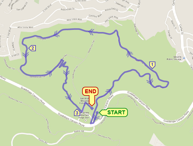
Run south 0.2 mile along asphalt path toward underpass; at turnaround head back to start. Then proceed along the Saddle Loop Trail running in a counterclockwise direction. Make a left onto Old Guadalupe Trail then right onto Bog Trail. At fork, stay left on Upper Bog Trail and continue back to starting area finish.
12K Course Map & Description
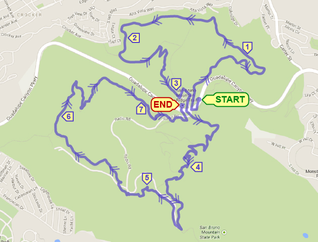
The course will follow the 5K course description above but then continue past the starting area 5K finish and follow the asphalt path through the underpass and out the southern side. Run left onto Eucalyptus Loop Trail. At fork, stay left onto Dairy Ravine Trail and continue up Dairy Ravine Trail. At next fork, run left onto Ridge Trail and continue to the top of San Bruno Mountain. At top, take a right onto Radio Road and start heading down. At Summit Loop Trail take a left and follow Summit Loop Trail all the way down to bottom, then onto path back through underpass to starting area finish.

